Mixed Metro
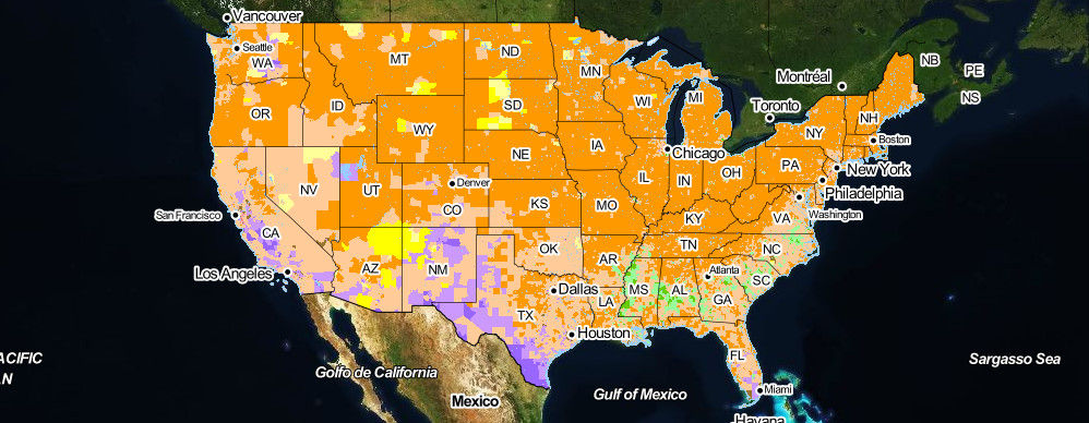
Mapping neighborhood racial diversity and segregation in the USA
Photo by Flickr user Mario Bollini
Race and Diversity
View maps classified by race and diversity. Maps are available for all 50 US states and the District of Columbia, and for the 53 largest US metro areas (with populations over 1 million).