A Simple Plan: Beautiful, Economical, Historically Site Appropriate
As pictured above, the plan is to
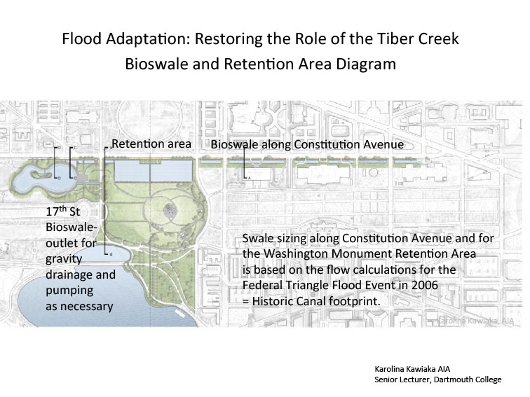
- Restore the path of Tiber Creek and Washington City Canal, and restore drainage for the low area in the Federal Triangle/Constitution Avenue
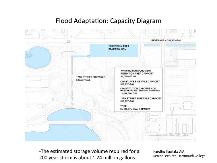
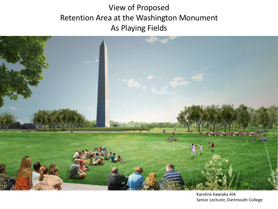
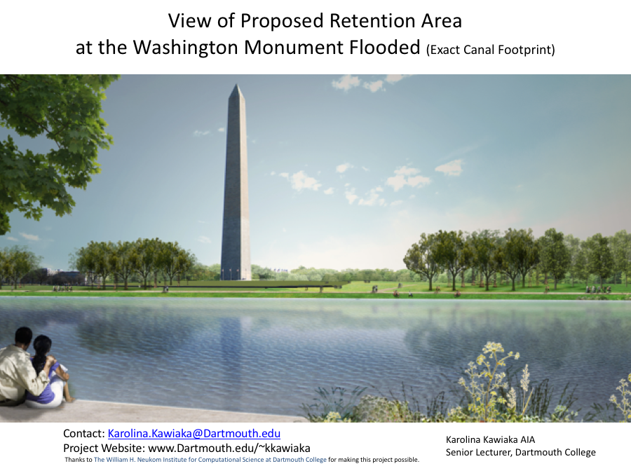
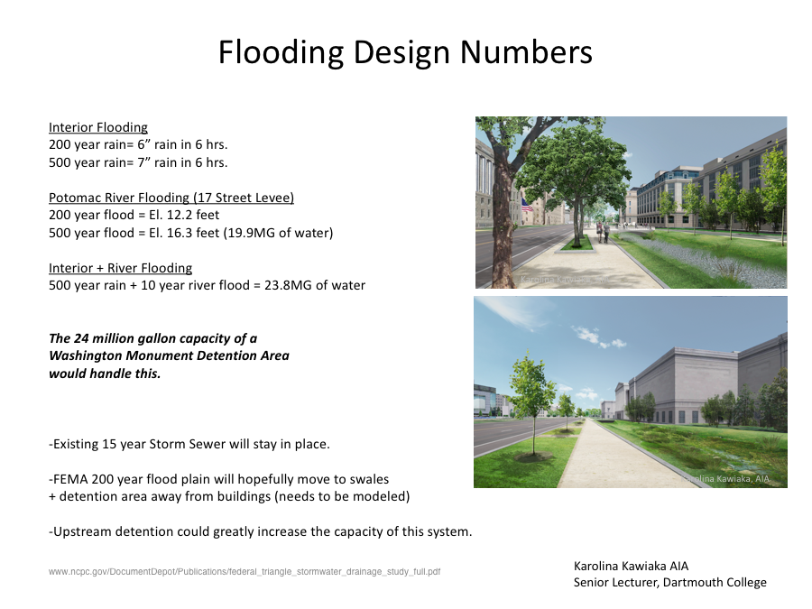
- Provide a flood control retention area near the Washington Monument on the original site the Washington City Canal with a 24 million gallon (MG) minimum holding capacity to drain the Federal Triangle area.
- In non-flooding conditions this Washington Monument Retention Area will act as a gathering place for events as it does currently.
- Provide an outlet for gravity drainage and pumping as necessary to convey water from the flood control Retention Area to the Tidal Basin by a swale along 17th Street thus restoring an outlet for the water draining from the Federal Triangle.
- Swale sizing along Constitution Avenue and for the Washington Monument Retention Area is based on the flow calculations for the Federal Triangle Flooding Event in 2006. Return the old stream path as bioswale to restore drainage and detention and restore an outlet to the Tidal Basin
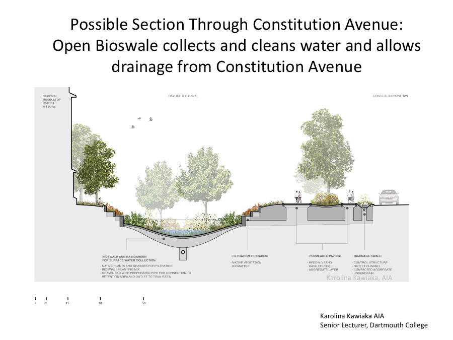
- Provide drainage for roof drains (rain gardens) and basement pumping from Constitution Avenue.
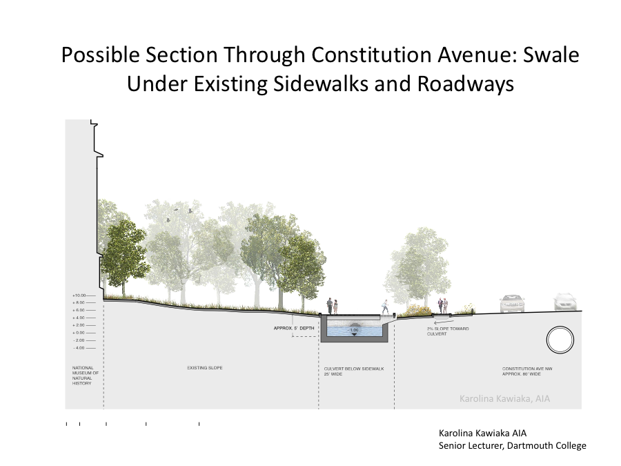
- Regrade the edge of Constitution Avenue to drain into culvert/swales that rain to large detention area
- Existing Storm Sewer to remain
- Low tech, uses gravity, always ready, acts as biofilters water
- Optional subsurface pump station proposed for fully unwatering the Flood Retention area will depend on the desired unwatering rate, but it is projected to be less than ten per cent of the 435 MGD pump station described in Alternative F (Greeley & Hansen 2011).
- Swale sizing is based on the Flow Calculations for the Federal Triangle Flooding Event in 2006.
- The 2006 flood occurred over about 4 hours where approximately 6 inches of rain fell from 9pm on June 25 to 1 am on June 26 (Reference Greeley and Hansen Report, Figure 3-1: https://www.ncpc.gov/docs/Federal_Triangle_Stormwater_Drainage_Study_Jul2011.pdf.
- The average flow rate over the four hour storm duration was approximately 144 million gallons per day(MGD).
- Proposed Washington Monument Retention Area effectively addresses the capacity of this system.
- The retention area can be unwatered over time after a flooding event by gravity and by pumping. Valves in the pumping station can be operated to prevent river flooding on the protected side of the 17th Street Levee.
- Swale along Constitution Ave. filters up to 24 million gallons of water on its way to a Washington Monument retention area, which is the est. storage volume required for a 200 yr. storm.
- The retention area can be unwatered over time after a flooding event by gravity and by pumping. The capacity will depend on the desired unwatering rate, but is projected to be less than 10% of the 435 NGD pump station described in Alternative F (Greeley & Hansen 2011). Valves in the pumping station can be operated to prevent river flooding on the protected side of the 17th Street Levee.
- 10 million gallons of water can be held at Constitution Gardens
- Water stored at Constitution Gardens can be accessed via pumps for either storm water runoff or Potomac River flooding
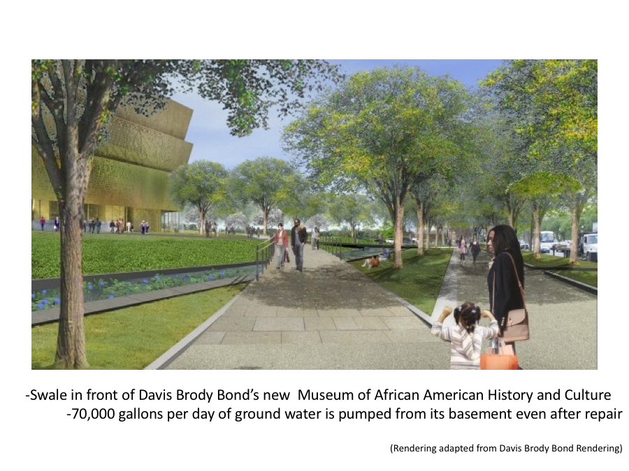
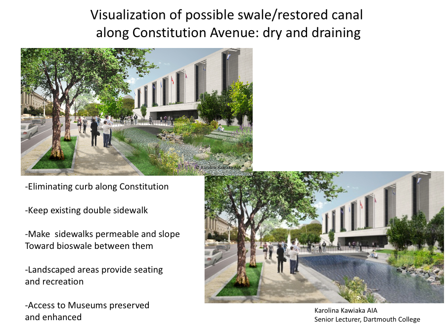
View artist's renderings of portions of the proposed solution, shown against a current map.